Free UK shipping when you spend £60 or more

Menu

Imray charts

What makes Imray charts unique?

Chart Clip Dark

Imray charts are based on official hydrographic office data, edited and augmented with additional information for small craft by our skilled cartographers.

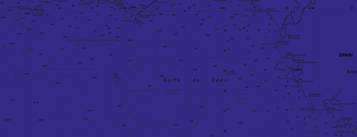
There’s a common perception that Imray charts are simply the same information as official charts but re-packaged or recoloured. 

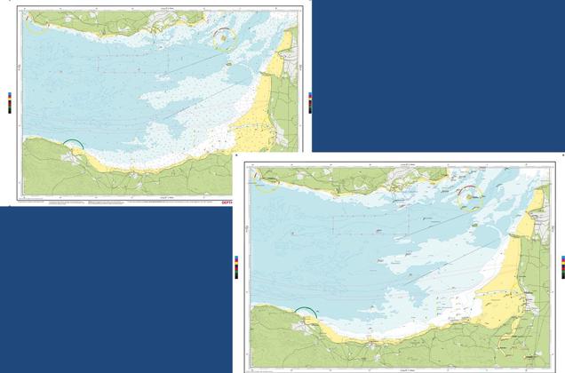
However, we have close ties with the UKHO and other hydrographic offices worldwide, and licence data from them. But we tailor the official hydrographic office data – which is primarily aimed at commercial shipping – to make it even more useful for small craft.  

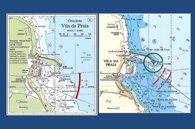
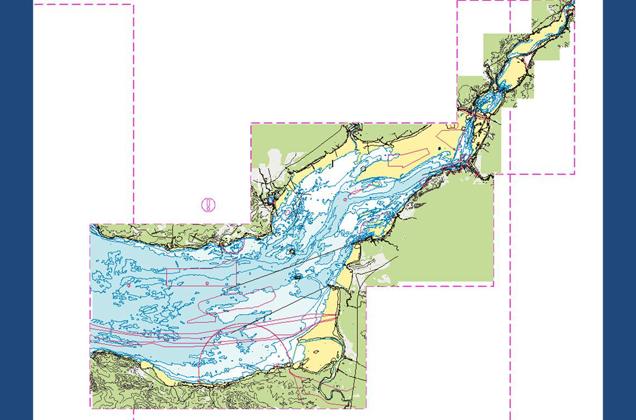
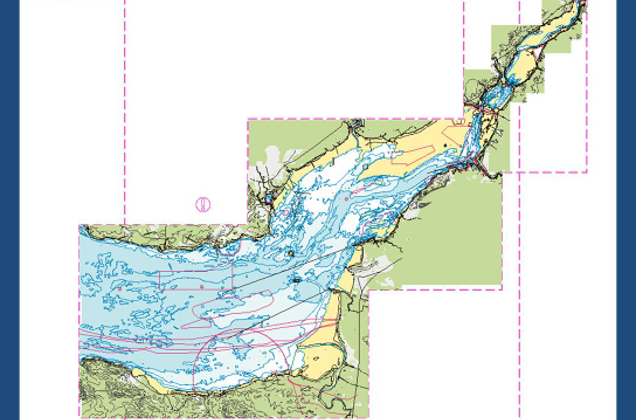
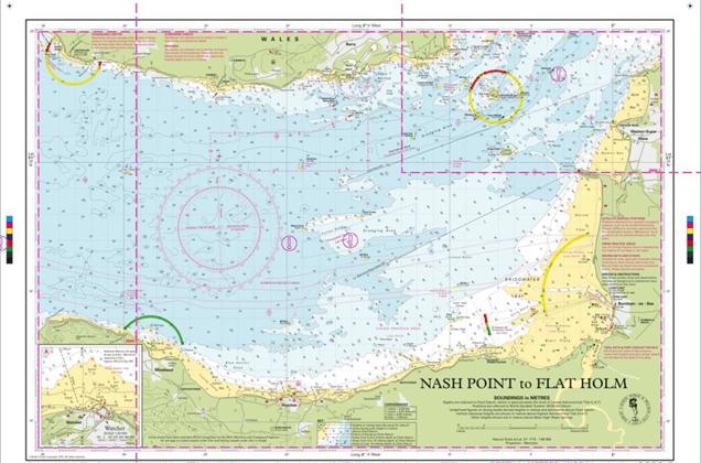
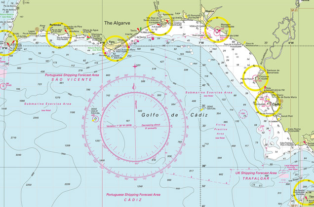
We add verified small craft information to our charts and present everything at more appropriate scales for the small craft navigator. There’s an emphasis on coastal and harbour detail. 

We use an intuitive colour scheme - green for land, dark blue for deep water, pale blue for shallow, yellow for sand and drying areas. 

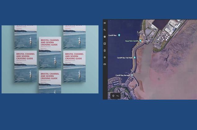
This customised combination of official data and small craft information is what makes Imray charts so useful.  We're also the only independent producer of charts to be recognised by the Maritime and Coastguard Agency for use on coded and fishing vessels under 24m. 


Making Imray Charts 1

Imray chart or official chart?

Compare a plan from an Imray chart (left) with an official chart (right). The Imray chart shows a small craft anchorage outside the breakwater, lit beacons marking harbour approach (rather than (buoyed), depths within harbour (rather than Unsurveyed), harbour facilities for small craft, contact details and a note explaining visiting yacht guidelines, availability of fuel and location. The Imray plan is larger scale (more detailed) and additional Imray information comes from a range of sources, including research by authors for pilot books

Making Imray Charts 2

1. Devising the chart scheme

Here is an example of an area in production – the Bristol Channel with some of the Imray product limits shown. The first stage in the production of our charts is to devise a scheme - the area that the chart or chart pack will cover. This is based on logical sailing areas at useful scales. For example, the passage from a headland to a harbour; an overview of an island; an approach to a river or estuary. This example shows the Bristol Channel against a generic map backdrop. The Imray chart extents are selected in red.

Making Imray Charts 3

2. Visualising the charts

This shows how the actual charts will look once the scheme above has been realised.

Making Imray Charts 5

3. Importing the raw source data

We license the official Electronic Navigational Chart (ENC) data from the hydrographic offices and import it into our database in an International Hydrographic Organisation standard format, S-57. Like all chart producers, we receive new deliveries of data on a quarterly basis. This shows the raw ENC data for the Bristol Channel. This forms the basis for both electronic and paper charts, but requires interpretation and editing to make it useful. A lot of data is shown on screen, at many different scales.

Making Imray Charts 7

4. Transforming the data

Using automated techniques, the data is imported, transformed and symbolised to Imray specifications. Data contained within the ENCs that is not relevant for small craft is removed (e.g. pilot boarding stations, deep water dangers, etc.) to retain clarity and make space for additional detail added later (eg. small craft facilities from pilot guides). We use familiar International Hydrographic Organisation standard symbols where available. Additional small craft symbols are created if necessary.

Chart 6

5. Trimming the data

Data is trimmed to the boundaries of the chart limits required.

Making Imray Charts 9

6. Adding soundings (depth data)

Depth information in the form of individual depths (soundings) are added from the ENC sources.The depths are simply filtered to match the scale of the output paper chart, data comes directly from the ENC. It starts to look much more like an Imray chart now.

Making Imray Charts 10

7. Adding Imray data

Additional data is added to the ENC source material. Sources are always meticulously verified, and include Imray pilot books, local experts, local port authorities and marinas, satellite imagery, etc. All of the data is traceable and its source recorded. This ensures that the charts are perfect for small craft and leisure customers.

Making Imray Charts 11

8. Final updates

Because the source data is only supplied by the hydrographic offices on a quarterly basis, final checks of Notices to Mariners, Imray chart correction notices, lights, etc. are made prior to publication to ensure the latest updates are included.

Making Imray Charts 12

9. The final chart is compiled

The final result is the Imray chart. The data is compiled, verified (manual quality control checks and automated quality control delivered through software tools), validated (compared to pilot volumes and local expert knowledge to ensure that it is correct for our customers, and is consistent across Imray product, and visually checked as a final paper product, outside of the software environment, to ensure quality. Then, it's published as a paper chart, or as a raster Imray Digital Chart.

Chart Clip

10. Printing and packaging

Paper chart files are then sent to our Print Room or to Print on Demand agents for printing and packaging. We print on bespoke water resistant paper using a HP PageWide large format printing press. Charts are then folded and inserted into sturdy recycled PVC wallets, or available flat on request.